Ben Laga is a rocky peak on the northern shore of Loch Sunart in Ardnamurchan. At 512 metres it’s the second highest top (after Ben Hiant, 528 m) on Ardnamurchan proper 1. As such, it gets far fewer visitors than Ben Hiant, a fact reflected in the absence of erosion on the paths to the summit.
Or, for that matter, reflected by the absence of any obvious paths to the summit 😄
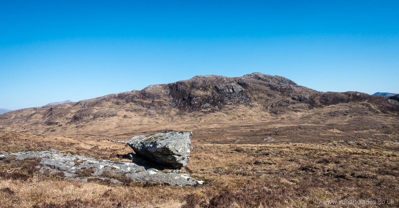
Ben Laga from the west with Beinn Resipol just visible over the ridge on the left
It makes for an enjoyable half day walk, with stunning panoramic views, or can be incorporated into a longer walk from Acharacle to Glenborrodale or Laga with ease.
Marilyn but not Munro
There are all sorts of lists of the hills of Scotland, defined by height and their separation from the adjacent tops.
- Munros – the hills over 3000 feet (914 m), first compiled by Sir H.T. Munro : 282 currently 2
- Corbetts – those over 2500 feet (762 m) but less than 3000 : 222 in total
- Grahams – hills over 2000 feet (609 m) but less than 2500 : 219 in total
At 1680 feet Ben Laga manages to avoid all of these lists … and is all the better for it.
It is, of course, a Marilyn – a hill with a prominence greater than 150 m – but with 1218 other Marilyn’s in Scotland there are a lot of other hills and it’s two-thirds the way down that list 3 so easily overlooked.
There and back
Ben Laga features in a couple of the guidebooks to walking in the region. Scotland’s Far West (Brook & Hinchliffe) has a ‘there and back’ route starting at Laga 4.
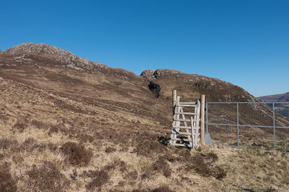
Ben Laga – from the gate through the deer fence at the top of Laga Farm woodland
The route climbs through the (increasingly lovely as it matures) Laga Farm broadleaf plantation 5, emerging onto the moor through a gate in the deer fence at NM634617 (see map – marker 1). It then strikes west northwest up the westerly slope of Ben Laga to the summit before ‘retracing your route to the start’.
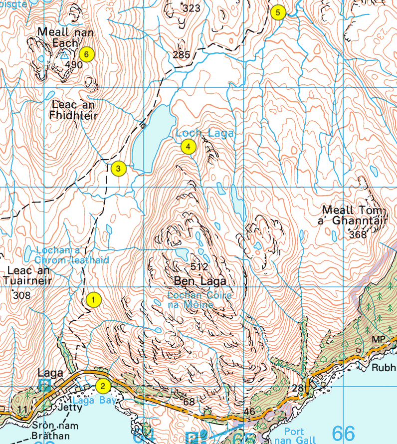
The area around Ben Laga
As routes go, it’s OK. But there are alternatives that are as good or better.
That’s the beauty of the trackless hinterland in this part of the world, thanks to Scotland’s freedom to roam rights … you can make your own route.
From the South
A few hundred metres east along the B8007 from Laga, overlooking Laga Bay, you can easily access the hill (marker 2 on the map, NM636610 6). Keeping the deer fence encompassing Laga Farm on your west you can traverse up the steep southerly face of Ben Laga. The going underfoot is a bit damp in places. However, this means that at the right time of year (e.g. mid-June to late-July), the lower grassy slopes are studded with bog asphodel and hundreds of stunning orchids.
A little higher and the bracken takes over, but there are well-trodden deer trails leading you upwards. Since deer cannot scale precipices you can have some confidence they’re not going to take you anywhere too vertiginous.
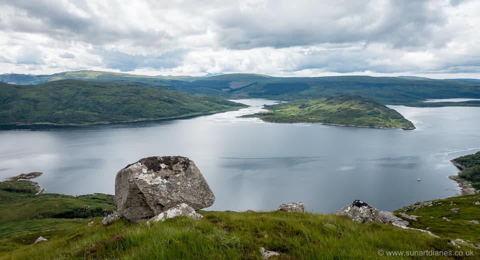
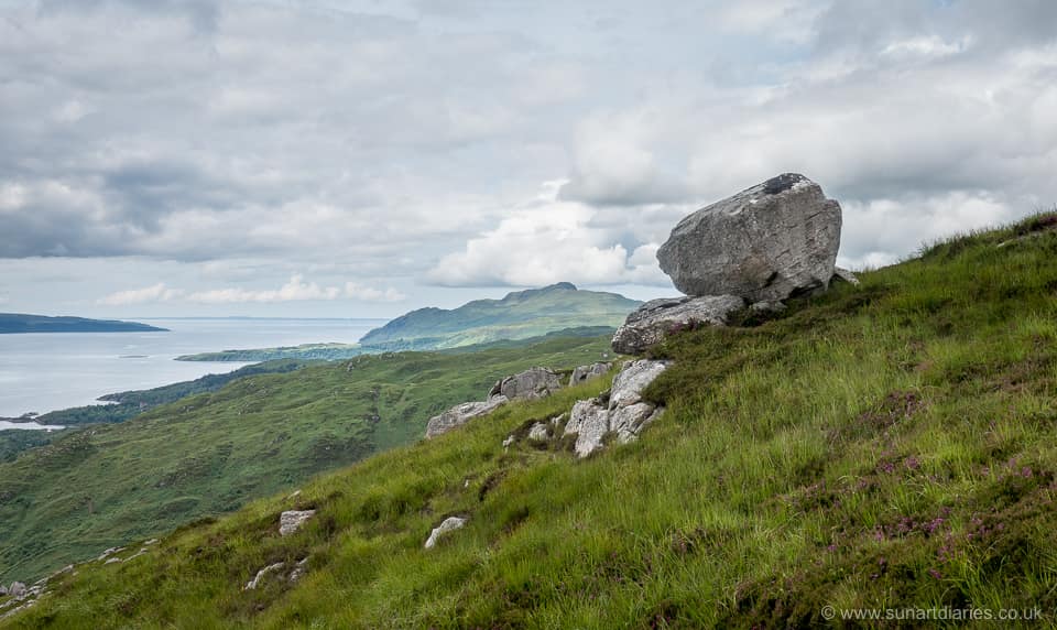
Ready to rumble tumble – Ben Laga erratic, overlooking Loch Sunart, Carna and Morvern. Laga is to the right.
Stopping to look back – and you’ll need to to catch your breath – the view opens up along Loch Sunart as you gain altitude. You climb past an erratic perched on the slope that looks ready to tumble down the hill onto Laga.
Ben Hiant from the southerly slopes of Ben Laga
About halfway up the ground levels and the rocky top of Ben Laga appears for the first time above the area drained by Allt nam Mearlach (which might translate to the Thief’s burn). Keeping to the east of the unnamed lochan, and of Lochan Coire na Mòine, there’s an obvious route towards the top up a steep slanting grassy gully between the rocks.
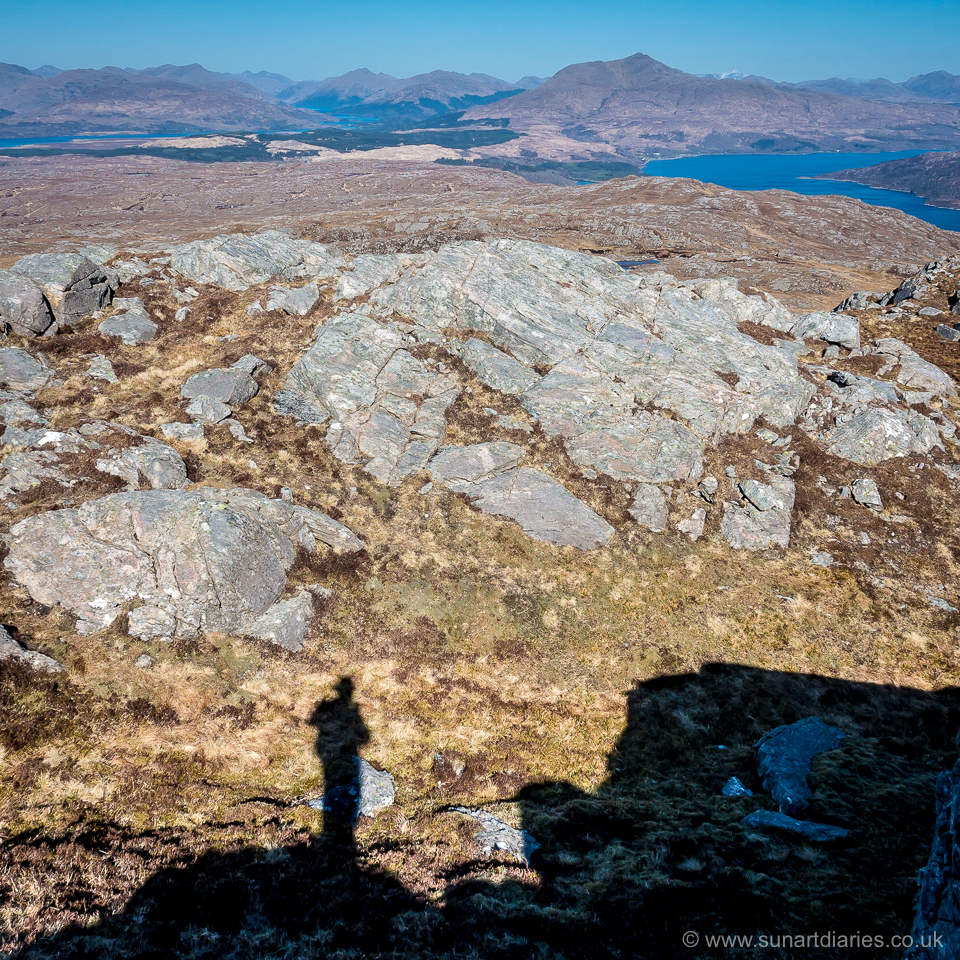
There are a couple of false tops, but the summit is obvious due to the presence of an inevitable cairn … and because it’s higher than all the other bits around. Since the summit is obvious it remains unclear to me why there’s a need to add a pile of rocks.
Stunning views
On a good day the views from the top are stunning.
To the east you have Beinn Resipol with a panorama of the high peaks of Glencoe in the distance.
Ben Laga selfie with Beinn Resipol and Ben Nevis (snow capped) in the distance
To the south and west you have Loch Sunart, Morvern, Mull and Ben Hiant.
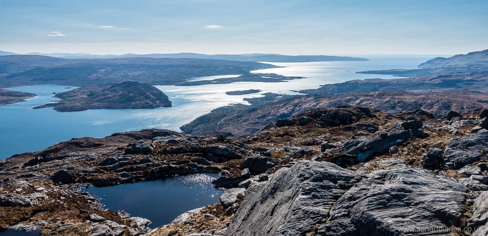
Carna, Loch Sunart, Morvern and Mull – April 2020
And to the north there are views over Lochan Sligneach, Kentra Bay, Camas an Lighe (the Singing Sands) to Eigg, Muck and Rum, with a more distant panorama of the Cuillin on Skye.
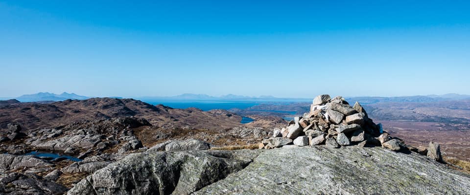
Ben Laga, looking north. Rum, Eigg and the Cuillin clearly visible. Lochan Sligneach in the centre foreground
There’s a small lochan north west of the summit, surrounded by a jumble of large rocks. Somewhere amongst them you can find a sheltered spot – from the icy wind or blazing sun, whichever predominates – for lunch.
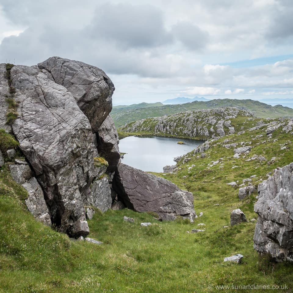
Ben Laga – summit lochan
Look out for eagles and merlin. I’ve seen both in the area.
To or from the North
The northerly spur from the summit towards Loch Laga makes for a fine descent if traversing the hill from south to north. The views remain excellent and the going underfoot is largely dry. Keeping above Loch Laga (map marker 4) you can cross the Allt Beithe a couple of hundred yards below the loch and easily join the track to Acharacle (marker 5).
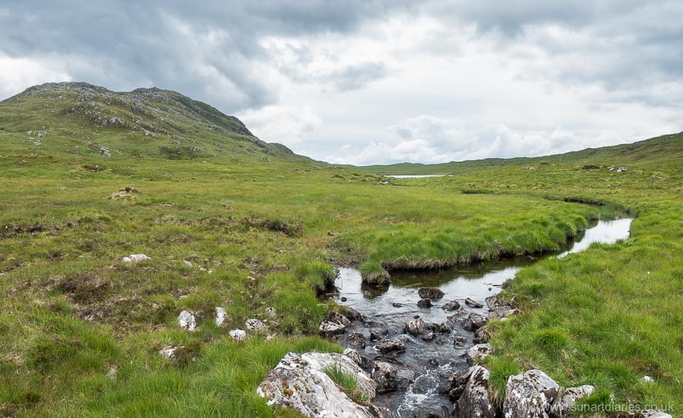
Allt Beithe and Ben Laga with Loch Laga almost hidden from sight
Alternatively, you can include Ben Laga in a circular walk from Glenborrodale, leaving the Glenborrodale to Acharacle track south of the junction with the Laga track (map marker 3). After crossing the boggy ground south of Loch Laga you rapidly gain height traversing up the westerly slopes of Ben Laga.
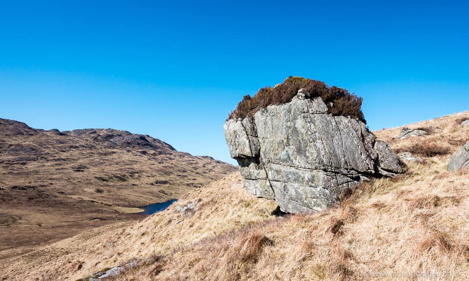
Ben Laga – erratic on the westerly slope overlooking Loch Laga
Keep bearing west rather than south 7 to reach the ridge, then turn south to the top.
And while you’re in the area
To the north west of Ben Laga is Meall nan Each (see map, marker 6). At about 490 m this makes a good walk on its own, or a very worthwhile extension from Ben Laga. As the 841st Marilyn in Scotland it’s rarely troubled by visitors 😉
Again there are no tracks to help you, but the routes up from the westerly shore of Loch Laga for example, are both straightforward and obvious. The summit has a trig point 8 and a small cairn (of course 😞 ).
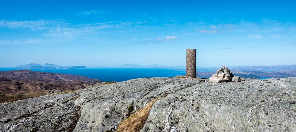
Meall nan Each trig point with Rum, Eigg and the Cuill, Skye, on the horizon.
If you descend Meall nan Each south along the rocky spur to Leac an Fhidhleir you can eventually regain the track to Glenborrodale or Laga, and from there the B8007.
References
Brook, D. and Hinchliffe, P. (2005) Scotland’s Far West. Cicerone Press. ISBN 978-1-85284-407-3.
-
The peninsula west of the A861 Salen to Acharacle road. ↩︎
-
Currently, not because the hills change height (other than on a geological timescale), but because the way we measure them gets more accurate. And, since presence on this list isn’t solely based upon height but also involves separation in height from adjacent tops, there can be revisions as mapping improves. ↩︎
-
Number 803 to be precise. ↩︎
-
Unfortunately this book now seems to be out of print. ↩︎
-
Note that parking is very restricted around Laga. Please do not park in passing places or driveways. There is ample parking near the school in Acharacle if approaching Ben Laga from the north. ↩︎
-
Which gets steeper and rockier. ↩︎
-
Like hills, there are people who catalogue these things. You can read more about its condition and construction if that’s what floats your boat. ↩︎